Property Record
638 Us Highway 441 Hwy N, Demorest, GA 30535
NEARBY LISTINGS FOR SALE OR LEASE
Property Detail
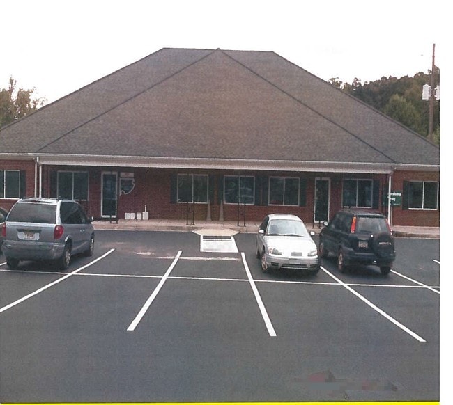
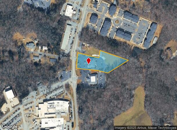
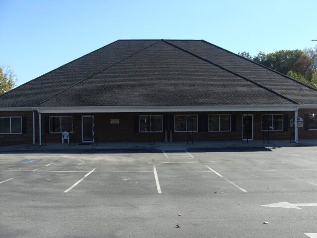
638 Us Highway 441 Hwy N
Cornelia, GA
Survey Prepared For J Terry Green
075-077
10-39 PB 26-79 & 48-207 600-578
Medicalbuilding
Habersham
X
Georgia
13137C0208D
39&44
2025
2.21 AC
2025
Georgia Northeast
000502
Other Market Areas
7,000 SF
DEMOGRAPHICS near 638 Us Highway 441 Hwy N
1 Mile
3 Mile
5 Mile
2024 Total Population
993
9,822
24,853
2029 Population
1,082
10,715
27,203
Pop Growth 2024-2029
+ 8.96%
+ 9.09%
+ 9.46%
Average Age
40
40
40
2024 Total Households
357
3,648
9,223
HH Growth 2024-2029
+ 8.68%
+ 8.91%
+ 9.18%
Median Household Inc
$56,323
$59,595
$60,687
Avg Household Size
2.60
2.50
2.60
2024 Avg HH Vehicles
2.00
2.00
2.00
Median Home Value
$186,701
$202,983
$188,391
Median Year Built
1983
1988
1990
Nearby Places
- Restaurants
- Banks
- Shops
- Fitness
- Groceries
Nearby Properties
Address
Land Use
TOTAL SIZE
Lot Size
Zoning
Address
Land Use
TOTAL SIZE
Lot Size
Zoning
216,507 SF
159.83 AC
MI
Address
Land Use
TOTAL SIZE
Lot Size
Zoning
253,404 SF
22 AC
HI
Address
Land Use
TOTAL SIZE
Lot Size
Zoning
97,985 SF
30 AC
LI
Address
Land Use
TOTAL SIZE
Lot Size
Zoning
144,690 SF
7.51 AC
HI
Address
Land Use
TOTAL SIZE
Lot Size
Zoning
57,800 SF
2.58 AC
SFR
Address
Land Use
TOTAL SIZE
Lot Size
Zoning
77,729 SF
69.23 AC
I
Address
Land Use
TOTAL SIZE
Lot Size
Zoning
55,608 SF
27.85 AC
I
Address
Land Use
TOTAL SIZE
Lot Size
Zoning
105,213 SF
8.49 AC
HI
Address
Land Use
TOTAL SIZE
Lot Size
Zoning
137,005 SF
20.74 AC
HI
Address
Land Use
TOTAL SIZE
Lot Size
Zoning
131,703 SF
15.25 AC
B1
Address
Land Use
TOTAL SIZE
Lot Size
Zoning
247,562 SF
26.58 AC
I
Address
Land Use
TOTAL SIZE
Lot Size
Zoning
66,865 SF
7.06 AC
R2
Address
Land Use
TOTAL SIZE
Lot Size
Zoning
175,337 SF
10.63 AC
I
Address
Land Use
TOTAL SIZE
Lot Size
Zoning
27,492 SF
25.58 AC
LI
Address
Land Use
TOTAL SIZE
Lot Size
Zoning
21,168 SF
5.32 AC
HI
Address
Land Use
TOTAL SIZE
Lot Size
Zoning
17,955 SF
12 AC
INS
Address
Land Use
TOTAL SIZE
Lot Size
Zoning
70,563 SF
9.66 AC
R1A
Address
Land Use
TOTAL SIZE
Lot Size
Zoning
8,725 SF
7.44 AC
LI
Address
Land Use
TOTAL SIZE
Lot Size
Zoning
183,619 SF
15.20 AC
MI
Address
Land Use
TOTAL SIZE
Lot Size
Zoning
30,632 SF
16.42 AC
LI
Address
Land Use
TOTAL SIZE
Lot Size
Zoning
44,885 SF
33.44 AC
LI
Address
Land Use
TOTAL SIZE
Lot Size
Zoning
72,402 SF
8.45 AC
HI
Address
Land Use
TOTAL SIZE
Lot Size
Zoning
50,890 SF
0.80 AC
CB
Address
Land Use
TOTAL SIZE
Lot Size
Zoning
87,830 SF
9.48 AC
B1
Address
Land Use
TOTAL SIZE
Lot Size
Zoning
32,210 SF
25.25 AC
HI
Address
Land Use
TOTAL SIZE
Lot Size
Zoning
66,994 SF
8 AC
I
Address
Land Use
TOTAL SIZE
Lot Size
Zoning
34,422 SF
1.50 AC
CB
Address
Land Use
TOTAL SIZE
Lot Size
Zoning
40,450 SF
2.20 AC
INS
Address
Land Use
TOTAL SIZE
Lot Size
Zoning
10,256 SF
1.35 AC
HB
Address
Land Use
TOTAL SIZE
Lot Size
Zoning
77,778 SF
18 AC
MI
The World's #1 Commercial Real Estate Marketplace
Connect with us
© 2025 CoStar Group
The information above has been obtained from sources believed reliable. While we do not doubt its accuracy we have not verified it and make no guarantee, warranty or representation about it. It is your responsibility to independently confirm its accuracy and completeness. Any projections, opinions, assumptions, or estimates used are for example only and do not represent the current or future performance of the property. The value of this transaction to you depends on tax and other factors which should be evaluated by your tax, financial, and legal advisors. You and your advisors should conduct a careful, independent investigation of the property to determine to your satisfaction the suitability of the property for your needs.